
Geology of the Bruneau Canyon, Idaho, U.S.A.
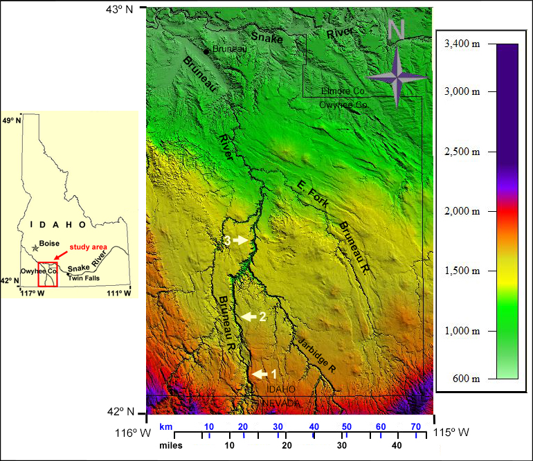
Figure 1. Map of the Bruneau River basin, Idaho
1-location of figures 2 and 3 (Blackrock escarpment). 2-location of figure 4 at 42º 12' N. 2-location of figure 5 at 42º 24' N. Data: 1/3 arc second NED (Courtesy of USGS).

Click on image for full-size zoomable image
Figure 2. Black Rock Escarpment, Bruneau canyon.
At approximately 42º 03' N, a few kilometers north of the Idaho-Nevada border, the eastern side of the Bruneau river valley is a steep escarpment called the Black Rock. View to the south-southwest. Credit: Bill Bonnichsen with special permission.
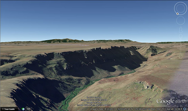
Figure 3. Blackrock Escarpment Google Earth view
View to the south-southwest as on figure 2. Notice the dissymetry between the two valley sides. The comparison of figures 2 and 3 allows to appreciate the accurracy of Google Earth imagery. Google Earth image © Google. Google and the Google logo are registered trademarks of Google Inc., used with permission.
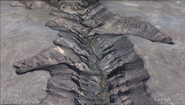
Figure 4. Southern Bruneau River valley
At 42º 12' N, the valley is deep but about 1,200-1,300 m wide. Its slopes are steep, but far from being vertical. Google Earth image © Google. Google and the Google logo are registered trademarks of Google Inc., used with permission.
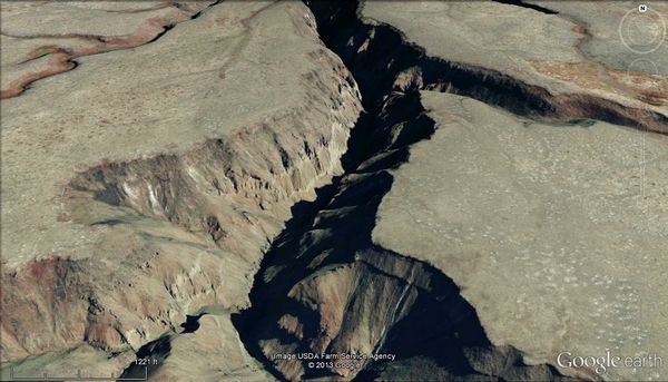
Figure 5. At 42º 24' N begins the spectacular northern stretch of the Bruneau Canyon
The most scenic part of the canyon starts at 42º 24' N in the center of the image; the valley shrinks to a width of about 500 m and the slopes become almost vertical. Google Earth image © Google. Google and the Google logo are registered trademarks of Google Inc., used with permission.